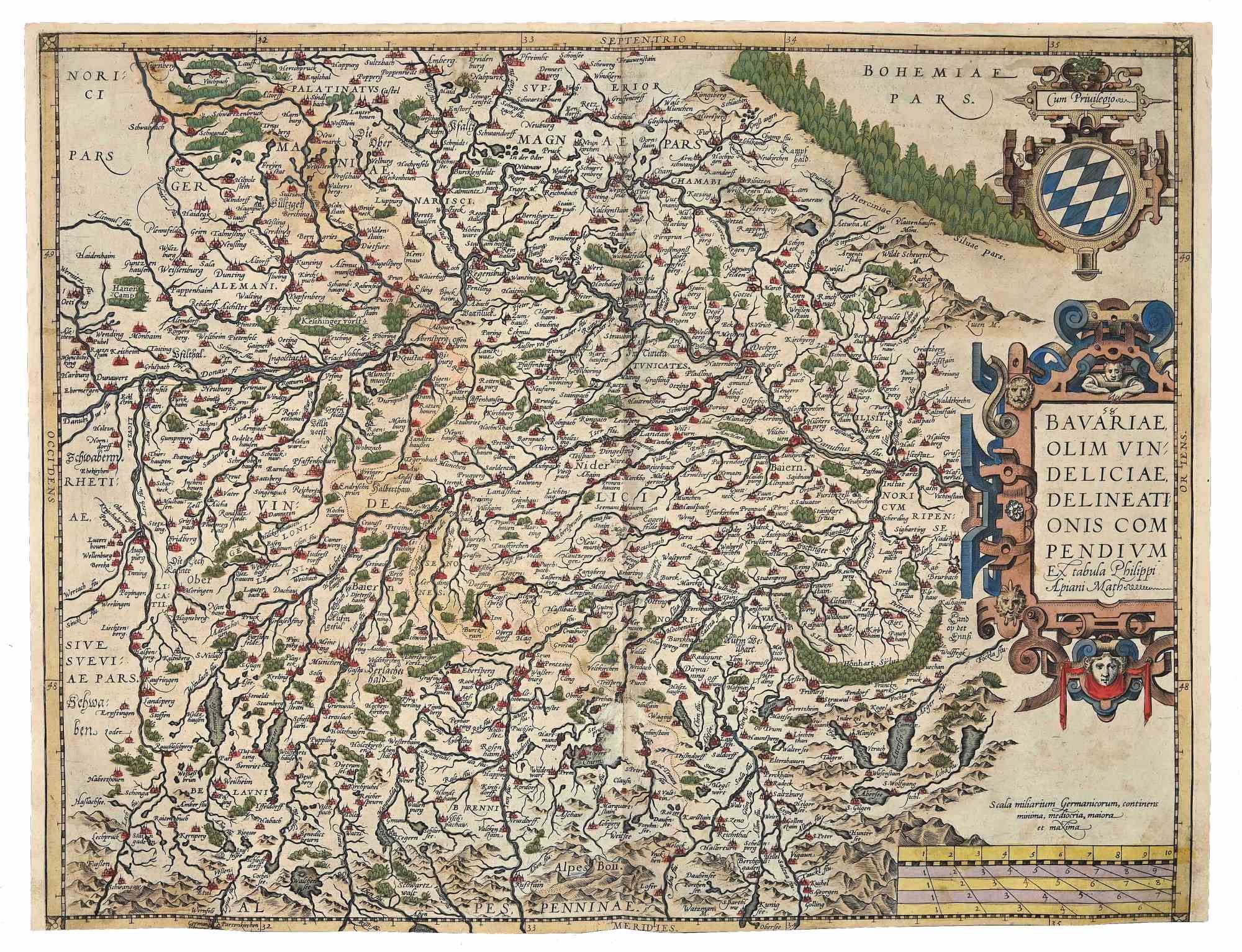
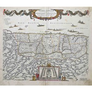
Map of Bavaria
Map of Bavaria is an original artwork realized in the 16th century by Abraham Ortelius (also Ortels, Orthellius, Wortels; Antwerp, 4 or 14 April 1527 – Antwerp, 28 June 1598).
Original etching with coeval hand watercoloring. From the series Theatrum Orbis Terrarus, Antwerp, Abraham Ortelius and Cristophe Plantin, 1584.
Map N. 58.
Total dimensions: 38.5 x 50 cm.
This wonderful engraving, with exceptional coeval coloring, is part of the first atlas ever created in western countries in the Renaissance period. It is considered a masterpiece of geography as well as of craftsmanship.
Koeman: "Shape and contents set the standards for later atlases, when the centre of the map-trade moved from Antwerp to Amsterdam. The characteristic feature of the Theatrum is, that it consists of two elements, forming part of a unitary whole: text and maps. This concept for a 'Theatre of the World' was followed through the 17th century. Before Ortelius no one had done this."
Good conditions. Normal signs of aging, yellowing sheet and folds in the center.
Discover More Interesting Old Masters' Artworks On Wallector.com!
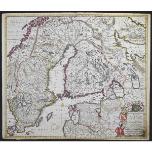
Map of Bavaria is an original artwork realized in the 16th century by Abraham Ortelius (also Ortels, Orthellius, Wortels; Antwerp, 4 or 14 April 1527 – Antwerp, 28 June 1598).
Original etching with coeval hand watercoloring. From the series Theatrum Orbis Terrarus, Antwerp, Abraham Ortelius and Cristophe Plantin, 1584.
Map N. 58.
Total dimensions: 38.5 x 50 cm.
This wonderful engraving, with exceptional coeval coloring, is part of the first atlas ever created in western countries in the Renaissance period. It is considered a masterpiece of geography as well as of craftsmanship.
Koeman: "Shape and contents set the standards for later atlases, when the centre of the map-trade moved from Antwerp to Amsterdam. The characteristic feature of the Theatrum is, that it consists of two elements, forming part of a unitary whole: text and maps. This concept for a 'Theatre of the World' was followed through the 17th century. Before Ortelius no one had done this."
Good conditions. Normal signs of aging, yellowing sheet and folds in the center.
Discover More Interesting Old Masters' On Wallector.com!
Abraham Ortelius (also Ortels, Orthellius, Wortels; Antwerp, 4 or 14 April 1527 – Antwerp, 28 June 1598) was a Brabantian cartographer, geographer, and cosmographer, conventionally recognized as the creator of the first modern atlas, the Theatrum Orbis Terrarum (Theatre of the World). Ortelius is often considered one of the founders of the Netherlandish school of cartography and one of the most notable figures of the school in its golden age (approximately 1570s–1670s). The publication of his atlas in 1570 is often considered as the official beginning of the "Golden Age" of Netherlandish cartography. He is also believed to be the first person to imagine that the continents were joined before drifting to their present positions.


Validate your login
Sign In
Create New Account