Old British Empire Map
Old British Empire Map is an artwork realized around 1760 by Karl Spruner .
Original hand-colored print.
Good conditions, except for yellowing of paper along the margins, and a little tear on the lower margin.
This important artwork represents Great Britain's sedentary possessions with the indication of their acquisition time, North America until 1783 and India around 1760.
This print is the plate n. IV from Historisch-Geographischer Hand-Atlas printed between 1848-1853.
Take a look at many more old masters' artworks online on Wallector.com!


Old British Empire Map is an artwork realized around 1760 by Karl Spruner .
Original hand-colored print.
Good conditions, except for yellowing of paper along the margins, and a little tear on the lower margin.
This important artwork represents Great Britain's sedentary possessions with the indication of their acquisition time, North America until 1783 and India around 1760.
This print is the plate n. IV from Historisch-Geographischer Hand-Atlas printed between 1848-1853.
Karl Spruner von Merz (15 November 1803- 1892), or Karl von Spruner , as he preferred to be called, was a German cartographer and scholar. He spent most of his long life in military service. He joined the Bavarian army, aged 11, in 1814, and was promoted to lieutenant in 1825. He is well-known for his historical atlases.
Take a look at many more old masters' artworks online on Wallector.com!
| SKU | M-103202 |
|---|---|
| Artista | Karl Spruner |
| Typology | Original Prints |
| Technique | Lithograph |
| Periodo | 1800-1849 |
| Conditions | Good (minor cosmetic wear) |
| Dimensioni (cm) | 36.5 x 0.1 x 45 |
-
 Bear and Elf from "Intermezzi"Special Price 1.050,00 € Regular Price 1.400,00 €
 -
 Fallen RiderSpecial Price 900,00 € Regular Price 1.200,00 €
 -
 Love, Death and the BeyondSpecial Price 1.050,00 € Regular Price 1.400,00 €
 -
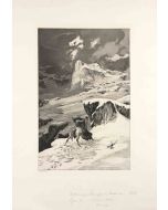
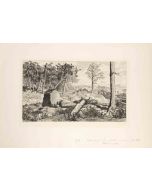 Opus IV, Simplicius in der Waldeinode (Simplicius in the Wilderness)Special Price 900,00 € Regular Price 1.200,00 €
 -
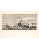
 Opus IV Unter den Soldaten RadSpecial Price 900,00 € Regular Price 1.200,00 €
 -
 Simplicius at the Hermit's GraveSpecial Price 900,00 € Regular Price 1.200,00 €
 -
 Simplicius' Writing Lesson (Simplici Schreibstunde) (plate VII) from IntermezziSpecial Price 900,00 € Regular Price 1.200,00 €
 -
 Moonlit Night from IntermezziSpecial Price 900,00 € Regular Price 1.200,00 €
 -
 Pursued Centaur (Verfolgter Centaur)Special Price 900,00 € Regular Price 1.200,00 €
 -
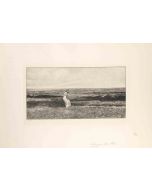 Seaside from IntermezziSpecial Price 900,00 € Regular Price 1.200,00 €
 -
 Kämpfende KentaurenSpecial Price 900,00 € Regular Price 1.200,00 €


-
 Celebration of Wood281,00 €
 -
 Cupid and Psyche6.000,00 €
 -
 Knight350,00 €
 -
 Sketch420,00 €
 -
 Countess Portrait300,00 €
 -
 The Rag Gatherers1.400,00 €
 -
 View of Piazza Navona380,00 €


Validate your login
Accedi
Creare un nuovo account