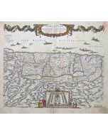
Ancient Map - Poli Arctici (Map of the Poles)
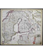
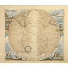
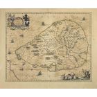
Ancient Map - Poli Arctici is an ancient map realized in 1650 by Johannes Janssonius (1588-1664).
The Map is Hand-colored etching, with coeval watercoloring.
Good conditions with slight foxing.
From Atlantis majoris quinta pars, Orbem maritimum [Novus Atlas, volume V: carte marittime]. Amsterdam: Janssonius, 1650. First edition of this famous work by Janssonius also known as the "Waterwereld"; is the first "maritime atlas (in the true sense of the word) printed in the Netherlands" (Koeman) and was published as the fifth volume of the Atlas Novus.
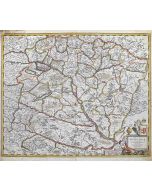
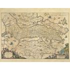
| SKU | T-141407 |
|---|---|
| Artista | Johannes Janssonius |
| Typology | Original Maps |
| Technique | Etching, Watercolour |
| Periodo | 1650-1699 |
| Year | 1650s |
| Signature | Not signed |
| Conditions | Good (minor cosmetic wear) |
| Dimensioni (cm) | 49 x 59 x 0.1 |


-
 Porcelain Lamp1.500,00 €
 -
 Civilisation à la Porte200,00 €
 -
 Gathering469,00 €
 -
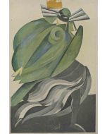
 Tribal Life188,00 €
 -
 Il Sepolcro di Ladislao220,00 €
 -
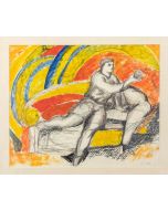
 Pleasure300,00 €
 -
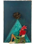
 Under the Sea825,00 €
 -
 Woman4.800,00 €
 -
 L'impiccato1.800,00 €
 -
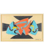
 Abstract Composition340,00 €


Validate your login
Accedi
Creare un nuovo account